
Features Draper Utah Trails
Draper City, Utah has 100+ miles of scenic trails throughout the valley and into Corner Canyon and surrounding mountain ridges.
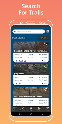
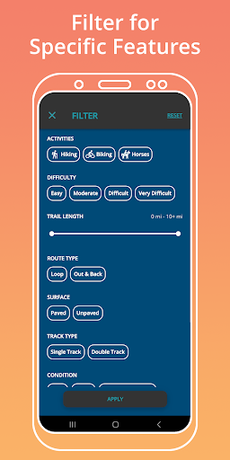
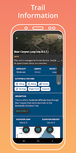
A variety of trails for hiking, mountain biking, horseback riding, dog walking, trail running and more. FEATURES- Search for trails within a certain distance from your location.- Filter for specific features: activity, difficulty, length, route type, surface type and more.- Detailed trail descriptions, including elevation information and nearby trailheads.- Stay informed when there are trail closures.- Download offline maps ahead of time.- See your location on the trail.- Select a trail and navigate to a trailhead from your current location.- Save your favorite trails.- Ability to switch between topography, aerial, and default basemaps.
Food & Dining
Discover recipes and order food from your favorite restaurants.
Pet Care
Manage your pet's health, activities, and care schedule.
Offline Mode
Use the app without an internet connection. Your data syncs when you're back online.
See the Draper Utah Trails in Action
Get the App Today
Available for Android 8.0 and above